Tranquility

Tranquility

Monday, March 19, 2012

Crossing Our Wake, "THE Crossing", A Year in Review

When "Loopers" get back to where they started, its called "crossing your wake".  Denise and I did that on March 17, 2012 in Madeira Beach, FL.  Eleven and a half months ago, on April 6, 2011 we left the bay where friends Geo and Nanc stay on their boat and when we returned they were there, even hoisting a congratulatory sign.

It was a nice surprise and made the finish a little more fun.  As you can see, while Denise was taking pictures of them, Geo was taking pictures of us.

Note the dirty bow, a water stain that comes from the tanins in the water.  After 6680 miles, Tranquility needs a good scrubbing. 

The finish line has been in sight for quite awhile ever since I arrived in Carrabelle, FL, in the pan handle, back on November 11.  It was there that I decided to leave her for the holidays and early winter.  I watched the weather throughout that period and good weather windows for crossing the Gulf were few and far between.  I was back in Carrabelle on March 5 and determined a suitable weather window was forecasted beginning on the 8th.  Geo made plans for transport up to Carrabelle and arrived late in the morning on the 8th.  Based on forecasts, we made plans to leave the Carrabelle harbor that afternoon and anchor behind Dog Island, just 5 miles away.  As recommended by a prominent Loop weather prognasticator, we went out into the Gulf through a series of bouys to create a GPS track that we could follow in the dark early morning hours of our planned departure the following day.

We were already 4 to 5 miles into the Gulf when I considered not going back to Dog Island, but continuing on.  It was 4:30 in the afternoon and seas were a little bumpy, but we concluded seas were in the forecasted 2 to 3 foot range and were probably as bad as we could expect overnight and into the following day.  The decision hinged on my being able to go to sleep at that momemt, so that I could be up by 11 PM to take the overnight shift.  With that, I said to Geo I was going down and if he didn't see me by 5:30, it was because I was sleeping and he should keep going.

I think I did sleep, what I call airplane sleep, where you are sort of aware of your surroundings, but are not really awake.  In any case, I arose when my alarm came on at 10 PM.  Geo had a couple of cocktails and went to bed at midnight.

The overnight wasn't too bad, with a full moon, the sea was fairly well lit and visibility was very good.  At one point I spotted lights in the distance and after awhile determined they were coming closer and eventually a sailboat passed on the port side about 200 yards off heading in the opposite direction.  Other than that, I did not see another vessel until well after the sun was up.  Surprisingly, Geo was not up until 7 AM, which allowed me for an hour and a half nap.

With daylight, came much calmer seas and as Clearwater Beach came into view, we decided to shift coarse 10 degrees more to the south and head straight to John's Pass at the south edge of Madeira Beach.  By 1:30 Friday afternoon on March 9th we were tied up at ABC Marina.  This concluded a 194 mile, 22 and 1/2 hour cruise.

I also got to Madeira Beach in time to have cocktail hour with my sister-in-law Sue, husband Mark and a few of their holigan friends from Massachusetts.

Denise arrived on March 12th and we spent the week basically getting ready to head north again in mid April.  Plans are to get Tranquility to Kenosha in July, where we can enjoy it only an hour and a half from home.  It was on the 17th that we left the marina and cruised back over to the bay at Geo and Nanc's to officially cross our wake.

That was also St Patrick's Day and we took the opportunity to celebrate Nanc's birthday, 3 weeks early.

This concludes the Great Loop, at least the first one.  Looking back on the year, I must acknowledge several people who became 1st Mates, Crew or just Passengers.

My 1st, First Mate is, of course, Denise.  To the surprise to many, especially herself, Denise survived, or as she likes to say, endurred a total of 2235 miles, or one third of the entire cruise.  While there were moments along the way, like "get me to shore NOW!", I knew she was handling it ok when she came back after two trips home early on and again to do some of the Illinois, Mississippi and Ohio Rivers.  I tried to tell her several times how well I thought she was doing, but she wouldn't talk about it for fear of jinxing herself.

Geo is probably the one person who without, I couldn't have even imagined doing this trip.  Our history goes back to 2001 and it was on my first trip with him going down the ICW in Georgia that I first spotted a trawler.  I didn't know that was what they were called, but it looked like a good way to cruise.  As they say, the rest is history.

Geo joined me for two of the more daunting legs of the cruise, the crossing of Lake Michigan and the recent crossing of the Gulf.  Neither of these turned out to be daunting at all, but it was comforting to have Geo aboard, just in case.  He also was along for one of the major side trips, that being the trip up the Tennessee River to Knoxville and then stayed aboard all the way down the rivers of Mississippi and Alabama.  In all, Geo was a first mate for 1682 miles, or 25%.

Somewhat surprisingly, my brother Ron travelled 1019 miles.  This is surprising because he suffers from some motion sickness and neither of us was sure how he would handle any rough seas.  He first joined in Albany, NY and easily survived the Erie Canal and then one calm day on Lake Erie.  He was aboard again for a couple of days on Lake Michigan and then again for a week on Kentucky Lake and the Tennessee River.  For 449 of Ron's miles, another friend of ours, Mark, was aboard.  During those miles Ron was a passenger and head chef.  When not preparing meals, pico de gallo, or margarita's, he was throwing rocks at signs along the Erie Canal and Mark was first mate.

In all, Mark was aboard for 552 miles and even captain for several miles on Lake Erie while I took a rare nap.

Tom, another good friend was aboard early on for 433 miles and solved a few nagging problems that arose just as Denise and I were departing Madeira Beach.  He also installed the stereo.  Tom, being a life time boater, took over the helm on many occassions.  He also got out the fishing pole on every chance.
 
Friends Mike and Patricia and their dog Scruffy Joe were along for 389 miles on a side trip up the Cumberland River to Nashville and beyond.  They set a new standard for fine dining with daily creations, including great hors dourves and even breakfast one rainy morning in Nashville.


Last, but not least, is my nephew Jason, who joined for the 154 mile trip from Kenosha, WI to Ottawa, IL.  Jason may have the record for the earliest happy hour at 10:30 AM, beating Ron by nearly an hour.

Also along for the 54 mile leg from Joliet, IL to Ottawa was Jason's friend Amanda.

And then there was me alone on three stretches.  Lakes Erie and Huron, a short stretch on the Illinois River from Ottawa to Peoria, IL and finally along the Florida Panhandle from Pensacola to Carrabelle for a 3 leg total of 594 miles.

Maybe you'll find interesting a few stats from the trip.

Total miles: 6680 miles
Total travel days: 111
Average miles per day: 60.18
Average speed: 8.6 MPH
Diesel fuel consumed: 2540 gallons
Average fuel efficiency: 2.63 MPG
Locks traversed: 79

It was a great trip.  Stay tuned for more adventures, planned starting date of April 20.

Monday, January 30, 2012

January 2012 Update

I think I suggested Tranquility would be moving again in January, but with the end of the month now here, I can tell you that won't be the case.  The boat is still at C-Quarters Marina in Carrabelle, FL and I have been by a couple of times to check on her and have decided to leave her there until early March.  I have booked a flight, so I am fairly certain I will move on across the Big Bend of the Gulf and back to Madeira Beach or near there, hopefully by about March 12, at least that's when Denise will be arriving in Clearwater Beach looking first in the marina and then out to the Gulf, if I'm not already there.

Geo is trying to arrange transportation up to Carrabelle to do the 15 to 20 hour crossing with me sometime around March 6.  The exact day for crossing is still very much weather dependent.  I have monitored daily weather updates since November and while there have been a few suitable crossing days, it apparently has not been a normal winter and the good days were few and far between.  Hopefully, by March it will be better.  I will probably spend the rest of March getting Tranquility ready to go again.

I haven't finalized plans, but we have decided we'd like to have Tranquility close to home for a month or two this summer and found Kenosha, WI to be a good spot, with a nice marina and only 90 minutes away.  So, the plan is to head back up the east coast, probably starting in mid April and shoot for a mid to late July arrival in Kenosha.

Postings will not be as frequent, but I will try for at least weekly updates.  Stay tuned.

Friday, November 11, 2011

The Blue Angels and More

There are few things I left out of the last post that I meant to include.

I mentioned how most mornings were cold, but forgot to include Geo's warning to me before I went on deck one of those mornings.  "Be careful, the deck is icy."  Ice?   I didn't expect such cold weather this far south.

Geo baked us corn bread to have with the black eyed peas I had in stock.  A good southern dish.

At mile 331 on the Tenn-Tom we met the tow "Chippewa."  This reminded me of the very unusual story from about a month ago that was posted on a daily loop blog I read.  A 43' trawler met the same tow, "Chippewa" at mile 317 and somehow capsized.  What actually happened has not been disclosed due to an ongoing investigation.  The four people aboard were able to get into their dingy and were picked up by another looper.  The boat was raised and taken to a marina.  We've been promised full details when they can share them.  Its hard to imagine how this could have happened.  The tow captain did say right after the incident that he thought mabye the tow had displaced virtually all the water in this narrow part of the river, causing the trawler to hit the bottom and then capsized when the water rushed back into that spot, but this hasn't been confirmed.  He said  his draft was 9 ft and he was in 11 feet of water.  Its kind of scarey that this can happen. 

Now back to the present.

When we were arriving in Pensacola we saw that there was going to be an airshow this weekend.  It was billed as the homecoming of the Blue Angels, which are based at the Pensacola Naval Air Station.  I didn't think I could hang around until the weekend to see the show, but then heard from another boater at the marina we were at that the Blue Angels would be practicing on Tuesday morning.  He also said that the practice was pretty much exactly like the show.  I was able to stick around for that.  I took a city bus to the Naval Air Museum that is on the Air Station base.  Right behind the musem is the runway and just as I walked through the gate, the Blue Angels were taking off.

For an hour I was thoroughly entertained by the Blue Angels.


I had about an hour in the musem after the Blue Angels.


I got back to the boat before noon and departed for the east.  I took this picture of an oil drilling rig on the ship that was docked next to the marina I was in.


This is still the central time zone and with the end of daylight savings last weekend, its getting dark before 5, so I only got 40 miles in on this half day.  I found a free town dock in Fort Walton Beach.  A bus stop was nearby and I took a bus, actually three buses, to the Hard Rock Cafe in Destin.  I added a beer glass to my collection.  But I had to take a taxi back because the buses had stopped running.

This Florida coast is similar in some ways to other parts of Florida.

But there are also long stretches of undeveloped, small barrier islands, more like areas of North Carolina we saw last spring.

The following day took me to just east of Panama City.   On the way, I passed Eglin Air Force Base, and noticed that I was right in the flight path of one of the runways.

If I had been there just 5 minutes later, this C-130 would have been landing right over my head.


I had identifed an anchorage from my Skipper Bob's cruising guide and as I was getting close, I was again treated to military jets not too far overhead, starting with this helicopter.

And just a few minutes later, these fighter jets.

A reveiw of the map and I discover there's also Tyndall Air Force Base, on a barrier island, just east of Panama City.  Lucky for me, the anchorage I chose was in the flight path and for an hor or so, I watched fighter jets just a few hundred feet overhead on their way to landing at Tyndall.


From here east the GIWW becomes pretty rural and not much like other parts of the Florida coast.


My destination for the day was Appalachicola, FL. 


Here was a city marina that offered water and electric for a flat $20 / day.  I had a phone number, but no cell phone service and according to my cruiser guide, there was no one monitoring a radio channel.  Fortunately, there was a couple outside their boat when I arrived and they grabbed my lines.  From talking to this fellow boater, I found out that the $20 was only if the dockmaster happened to come by.  There wasn't an actual marina office and he also said he heard they don't always charge and they didn't this time.

High winds over night created 2 to 4 foot seas in Appalachicola Bay, but the forecast called for subsiding winds and waves for the afternoon.  I was talking to a another looper, from Milwaukee, who was also hoping to leave in the afternoon too, but he couldn't because his boat was actually sitting on the bottom.  With a full moon the tide is more significant and when combined with strong northerly winds, the water at the dock was pretty low.  I waited until 2 and a little of the rising tide and was able to get off the dock and on to Carrabelle, just 29 miles to the northeast.

Dolphins have been plentiful ever since being back in Florida and as usual getting a good picture is lucky.  I don't necessarily have good pictures, but I made plenty of attempts.


Appalachicola and Carrabelle are the two logical spots to leave from to cross the corner of Florida to Tarpon Springs or Clearwater Beach, so there are a few loopers in both spots waiting for a good weather window.  Tonight is going down into the low 30's and strong winds are again forecasted for the next couple of days.  From Carrabelle it is approximately 180 miles across, but it will be early January before I come back.  I'll post some final stats of the trip when I'm back in Madeira Beach, but can tell you that I am at 6450 miles with today's trip to Carrabelle.

Sunday, November 6, 2011

It Still Beats Working

After the layover for the rainy day in Decatur, the sun came out as promised and we were again underway. 

Decatur is a very industrial area.


There were two locks to get through before a planned stop back in Florence, AL.  We heard from the lockmaster at the first lock that there was a tow at the second lock and a few pleasure crafts waiting.  It was the Wilson Lock and 15 miles away, he thought we might just make it and be able to pass through with the other boats.  I'm glad we didn't take any drastic actions to hurry our arrival, because the tow hadn't completed its passage and four other pleasure craft were still waiting.  Two more arrived and we were delayed further when the lockmaster advised there was a malfunction and he had to wait for maintenance to fix it.  It was over an hour before we all moved into the lock.

I posted about the Wilson Lock when Ron and I were making the trip up the river.  At 95 feet, it is the biggest lock of the trip, but going down was different than going up and we were the last ones in, so right in front of the rear door, which turned out to be a wicket gate that came up from below.


As we went down, water flowed from the gate, creating a waterfall.


It was a long way up when the water was all out.

When the doors opened we were second to last in a parade of boats.


The Florence stop was quick.  I had called and asked the marina dockmaster if I could pay her to borrow the courtesy car, even though we were'nt staying for the night.  She remembered me and said I could use her car, which we did.  Denise had arranged for my prescriptions to be filled there.

We went a few more miles and anchored for the night.  We planned for an early start, actually, Geo always wants an early start because he's usually up before the sun, while I can easily sleep until well after the sun is up.  It worked out for me, because again it was foggy.

At mile 217 of the Tennessee River we made the turn on to the Tenn-Tom Waterway.  Actually, the Tenn-Tom starts at the mouth of the Tennessee on the Ohio River and runs 667 miles to Demopolis, AL where it meets the Black Warrior River. 

This completed my side trip further up the Tennessee to Knoxville.  In all, the Tennessee is navigable for 650 miles.  I completed 620 of them, missing the first 25 because I went up the Cumberland to Lake Barkley and joined the Tennessee from there and the last 5 because downtown Knoxville is mile 645 and I didn't go all the way to mile 650.

The first part of the waterway off the Tennessee is a 39 mile canal that connects it to the Tombigbee River.  We are now back in Mississippi.

Like all the other canals on this trip, there's not really much to see, so I took pictures of bridges.


There are 11 locks between here and Mobile.  Eight of them in the first 150 miles.  It took us 3 days to cover the 150 miles.

We did have some entertaining momemts though.  As I came up behind a tow, I made the normal call and asked the tow captain if it would be possible to get a pass.  He came back in the thickest southern accent you can imagine and said "anything is possible."  I then asked if it would be advisable and he said "come on."


After I passed, he called and said, "see how easy that was."

Geo hasn't quit smoking yet and he tried to burn up my Skipper Bob's River Guide.

As we approached Columbus, MS, I started hearing and seeing Air Force fighter jets, lots of them.  There was obviously some training going on as we would see a jet and then a few minutes later a couple more chasing the first one.  I took lots of pictures, but its really hard to catch them.  But then two came low right overhead.

Most mornings were foggy and cold.  We arrived at this lock as early as possible.

Some old bridges.


We also came upon another deer crossing the river and had to slow down to not hit him.

For most of the time through Mississippi I did not have cell phone service.  Maybe that's why someone had put this along the bank of the river.

A few miles south and east of Columbus, MS the waterway re-enters Alabama.

Late one afternoon, the temperature of the starboard engine started going up and eventually I had to shut it down.  We continued on one engine and it was late before we reached a suitable anchorage.

Luckily, Geo was with me for the engine overheating problem.  It turned out to be a worn out impeller in the engine cooling system and I had a spare.  Getting the old one out was easy, but both of us tried to get the new one in and finally Geo was able to get it.  This solved the problem.

I had read and seen pictures of a stretch of the river that is lined with white sandstone.


We found ourselves the first boat in a lock that eventually filled with seven more.

Most of these were bigger than Tranquility, but one was not.

And they were doing the loop.

All of these boats were going to cruise faster than us, so we let them by, but ended up locking through with them again the next day.  It was helpful for them to be stretched out ahead of us because we could hear the radio call to tows and know when we were going to meet or overtake one.

One boat was a half mile or so in front of us and began an exchange with a tow captain.  At one point the tow captain told him he was going to be in the way and when he asked where he should go, the tow captain told him to go on the sandbar.  The pleasure boater thought he was kidding and then we heard the tow captain said he had no choice and he ran his barge into the bank to avoid hitting the pleasure boat.

He then called me and said to step on it and get past him, which I did.

We usually follow the Skipper Bob's guide to find suitable anchorages and this one turned out to be quite nice, but a little tight getting into. 

We encountered a couple of unique boaters along the way.


As we got closer to Mobile, AL the landscape started changing to marsh.

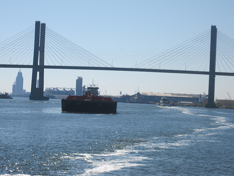
Take a close look at this picture and you can see the skyline of Mobile.

The river runs right through downtown and the waterfront is all about shipping and ship building.


After a relatively short trip through downtown, we were heading into Mobile Bay.

It was 31 miles to the southeast corner where we would enter the Gulf Intercoastal Waterway, (GIWW).

The GIWW was right where the chart said it would be.

We called a marina that we had read had a good water front restaurant where we could watch the big Alabama-LSU game.  Since we were still in Alabama, we figured it would be fun.  There were even a couple of LSU fans.  It was a good game, but not very exiting and LSU won.

We were only going 15 miles today, to Pensacola.  Just a few miles from the anchorage we were back in Florida.

It doesn't look very promising for a Gulf crossing anytime this week and we have flights home on Nov 16th.  We had to make a decision several days ago, in order to get decent flight prices, so we booked from Pensacola.  Since we are already here, Geo has decided to rent a car and drive to Madeira Beach to take care of some business and check on his boat there.  I have decided to keep going alone across the Florida panhandle to Carrabelle, where I have found a marina to leave the boat for awhile.  Geo will drive back early next week to Carrabelle and then we will return the car in Pensacola and catch the flights home.

I will post once more when I get to Carrabelle.   I'm not sure exactly when I will come back to make the Gulf crossing and finish the first loop.